Products
Professional Services
Demos and Downloads
Help and Support
Products
Professional Services
Demos and Downloads
Help and Support
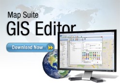
 The Map Suite GIS Editor is a powerful, easy-to-use tool for viewing, styling and editing geographic data. Whether you need to visualize an area the size of a building or the size of the entire world, the GIS Editor makes the process simple. You can use it to analyze and geoprocess data, visualize and style data, or even design attractive page layouts for printing.
This wiki acts as an in-depth user manual for the GIS Editor. Browse the list of topics below to find help for the portion of the application that you're working with, or use the search to locate something specific.
Getting Started
General
Adding and Managing Data
Styling a Map
Processing Data
Creating and Editing Data
Labeling a Map
Selecting and Querying
Printing
Developers
Measuring
8501 Wade Blvd Ste 550
Frisco, TX 75034
United States
sales@thinkgeo.com
1-785-727-4133
Online Store
- Desktop
WPF
WinForms
- Web
WebAPI HTML5/JavaScript
ASP.NET MVC
WebForms with AJAX
- Mobile
iOS
Android™
World Street
World Imagery
Routing
Geocoding
Reverse Geocoding
Elevation
Quick Start Guides
Documentation
Blogs
Discussion Forums
Customer Portal
About Us
News & Announcemets
Privacy Policy
Copyright 2003-2017 ThinkGeo LLC.
All rights reserved.